Terrain Modification in HEC-RAS 6.0
In this article, we’ll walk through the steps of modifying terrain data with HEC-RAS using video tutorials. If you would prefer to follow along with the written steps, check out our blog post here.
Features
You can use HEC-RAS to modify your terrain in any way you see fit; in this model, for example, we use terrain modification to build fences around sheep pens just for fun:
Now if you’d like to try it yourself, you may want to start with something a bit more practical; some of the features we build into our terrain in the instructional videos below include:
- Levees
- Roadways
- Building pads
- Channels/drains
- Detention basins
- Canals
- Floodways
- Bridge decks
- Dredging
- Bathymetry
Are there any other features you’ve added to previous models or that you would like to add to future models? Let me know and I’ll add some examples. Basically, anything you can draw in a series of cross sections – so long as it doesn’t cross over on itself (sorry, no caverns!) – can be added to your terrain.
New Terrain Modification Tools in HEC-RAS 6.0
Here are a few videos highlighting the new terrain modification tools in HEC-RAS 6.0. While very handy, these tools do not entirely replace the previous method of using cross sections in a 1D geometry, so we’ve kept the previous tutorials below.
Data Sources
If you don’t have your own terrain data, you’ll need to grab some first. Coarse-grid (~30 metres) digital elevation models are freely available from SRTM data for the entire planet, but you may want to get a bit more resolution than that. In Workshop #1 of our HEC-RAS 5.0 course, we import terrain from the free ELVIS database hosted by Geoscience Australia. [For those who haven’t taken the course, feel free to download Workshop #1 as a pdf file and follow along with the instructions.]
At the end of Workshop #1, we should have terrain data loaded into RAS Mapper. Once we’re at that point, we can adjust the terrain to include any number of features and then compare the results with and without the feature in place. The video instructions below use the free terrain data from the ELVIS server for the Brisbane River in Australia. Follow along or modify your own digital elevation model using the steps in these tutorials:
Boooooring…
Putting a regular old culvert or bund into your model may feel a bit mundane; so in our courses, I try to take a different approach to make the process a bit more palatable.
Here’s my allegory: My daughter hates peas. But if I make the process of eating peas more fun for her, she tends to forget that she hates peas. (This a variation of the old airplane trick, which has lost its effect over the years.) I’ve found this new approach to be quite effective: we toss the peas into the funnel, and she has a good time trying to keep up. [There’s nothing to see here, Child Services, please move along!]
Along those same lines, in our HEC-RAS course, doing something completely different can be a bit more fun (and keep attendees awake when it gets to that time of the afternoon on the last day…)
First, I usually let course participants choose what I should put into the terrain in the demonstration model. One time I was asked if I could make levees in the shape of a client’s logo. Luckily it was a fairly simple shape, so we embedded a 10-kilometre diameter logo into the Bonneville Salt Flats and ran a flood over it. The possibilities are endless!
I also like to let everyone choose their own location for workshop exercises. We try to use real projects where possible, but if there is time, we also go online and find free DEM data anywhere on the planet and try to out-engineer each other. We’ve done some pretty interesting (and very much hare-brained) projects in class, for example:
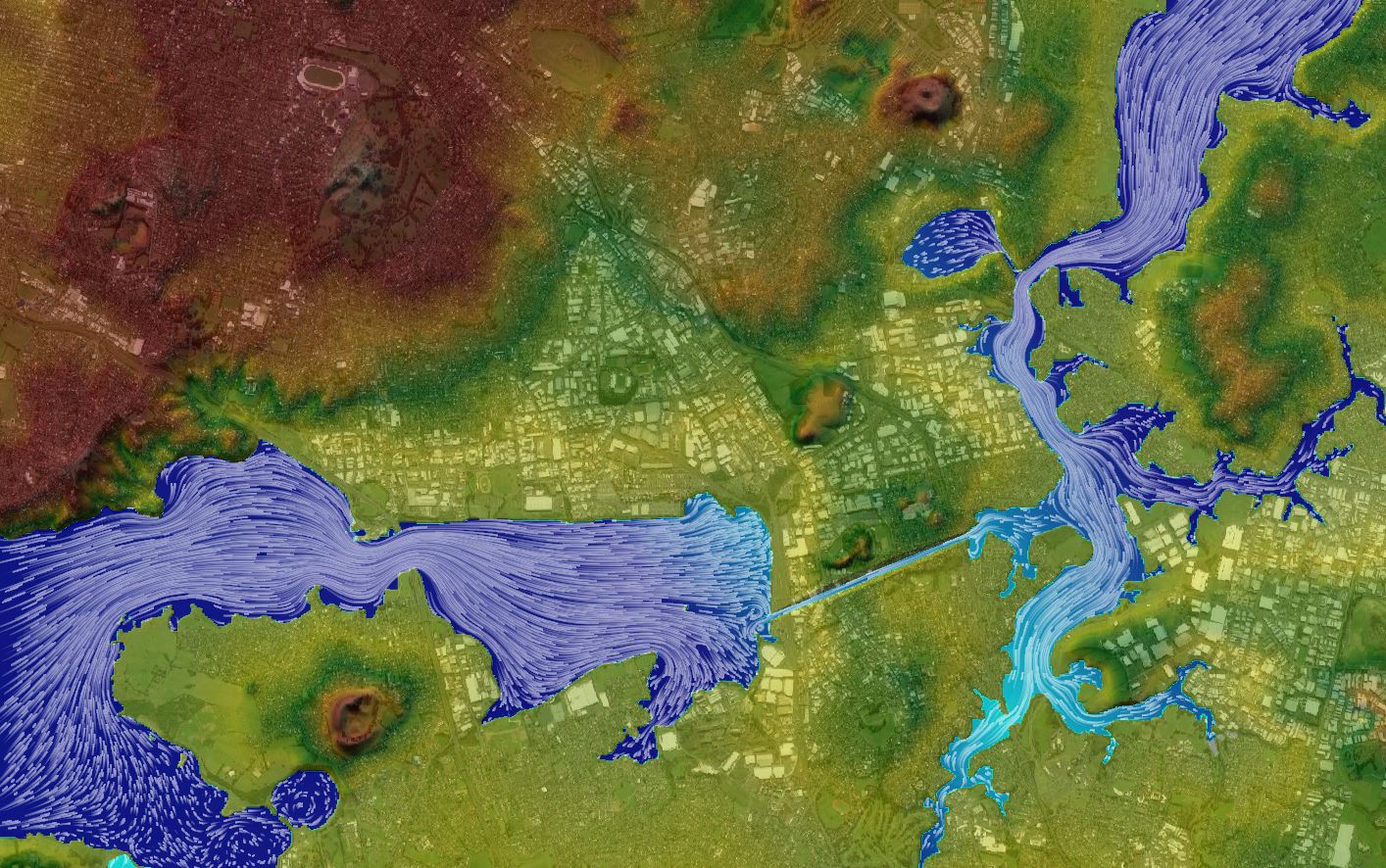
- Slice New Zealand’s North Island in two and generate tidal power with the out-of-phase tides across the canal – follow along with this exercise here.
- Take the subsurface bathymetry of Sydney harbour, drop the sea level, put a dam across the inlet, fill in the harbour, and let the dam fail.
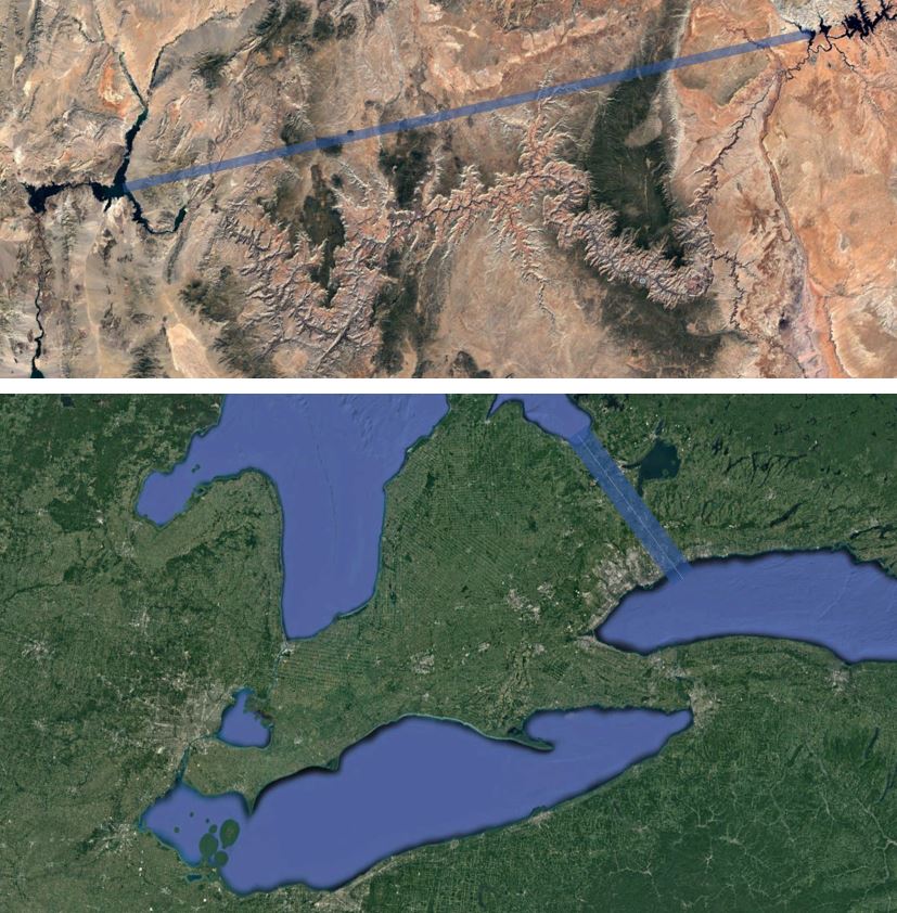
- Dig a Grand Canyon Bypass that connects Lake Powell to Lake Mead with a straight L.A. River-style trapezoidal monstrosity (that unfortunately also wipes out some of my favourite National Parks!).
- Construct a Dutch-style seawall across the Strait of Gibraltar, turn the Mediterranean Sea into a reservoir, and control its elevation with gates.
- Create a Niagara Falls Bypass that connects Lake Huron’s Bay to Lake Ontario, bypassing Lake Erie completely (and unfortunately displacing a few thousand homes in the process).
- Put the 600-metre high ice dam back on the Clark Fork and recreate the Missoula floods through the Columbia Gorge;
- Rebuild the Red Rock Pass spillway to re-create Lake Bonneville and then drain it back to the Great Salt Lake by excavating another outlet to the Ocean;
- Construct the fabled Northwest Passage by connecting the Missouri River with the Columbia;
- Put a canal across the Swiss Alps or the Himalayas
- Make reservoirs out of craters on the moon, or even put a dam across palaeochannels on Mars!
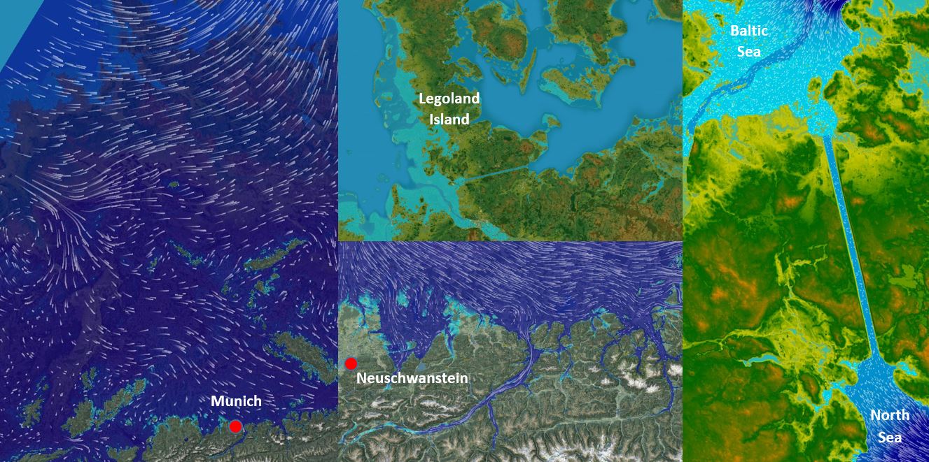
Here’s an example from our upcoming course in Munich that includes building a mile-high dam across the Alps and severing Denmark from Europe with a big ol’ canal, creating Legoland Island in the process!
Here’s a video animation:
[This one’s in German – to see the translation, view the video on YouTube and scroll down to the description. Or check out more videos in our HEC-RAS series here.]
Now you may need to use upwards of 1 km grids for some of the larger examples I’ve listed, but you can scale projects up or down to suit your needs. If you’ve got to practice with something, you might as well think big! Why learn the ropes with a boring old bund or drain? It doesn’t take any extra time to use real locations for your example projects now that Google can hook you up with free DEM data anywhere in the solar system, so go crazy with it!
What’s next?
For written steps on modifying terrain data with cross sections, see the new terrain modification post on the HEC-RAS blog. There are also some previous posts titled “Terrain Lifting” (for building a raised surface such as a roadway, bund, levee, or building pad) or “Bathymetry” (for excavating a drain or removing a water surface of a channel or reservoir to account for bathymetry).
The functionality in HEC-RAS is a bit limited, particularly in terms of projecting cut or fill templates to daylight, but you can still do some pretty cool things with it.
In addition to the techniques described in the blog post, the Channel Modification tool – which has been part of previous versions of HEC-RAS and HEC-2 as the Channel Improvement card for quite some time – can now be used in whole new ways when combined with RAS Mapper. The Channel Modification tool automates the process similarly to what can be done with templates/assemblies in InRoads, Civil3D, 12D, or other civil design software. Sure it’s a bit less versatile than the other packages, but after all, it’s free!
We are also working on a new software application that will allow you to modify terrain with polygons while applying rules for daylighting cut and fill slopes. Sign up for notification of release dates or to be a beta tester at https://www.surfacewater.biz/3d/.
And if you end up doing something even more hare-brained than the crazy engineering feats I’ve listed here, I’d love to hear about it. Send me a link and I’ll feature it here!


