Wormhole Culverts Part 3
The Trial: 1D Bridge/Culvert vs. 2D Connections vs. 2D Wormhole Culverts
- Wormhole Culverts Part 1: Introducing the wormhole concept
- Wormhole Culverts Part 2: Using wormhole culverts for internal boundary conditions
- Wormhole Culverts Part 3: Comparing wormhole culverts to 1D/2D bridges and culverts
- Wormhole Culverts Part 4: Sensitivity analyses for wormhole culverts
- Wormhole Culverts Part 5: What’s the best shape for a wormhole culvert?
April 2018 update
[PLEASE NOTE: Wormhole culverts have become obsolete with the release of HEC-RAS Version 5.0.4. See our new article on what’s new in 5.0.4 for instructions and videos on using the new culvert options.]
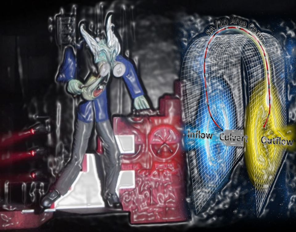 “Good morning Worm, your honour…”
Introduction
Since SMEC’s Con Katsoulas first told me about his creative workaround for the long culvert limitations in the current version of HEC-RAS, I have used this approach on hundreds of culverts in my models, and the online post (Part 1 of this series of articles) has received thousands of hits. Quite a few users have told me they now apply the method regularly in their models; this makes me a bit nervous: I have confirmed that wormhole culverts work in principle, but how valid are the hydraulics over the full range of open channel flow, pressure flow, and weir flow? Given the amount of use they are getting, I think it’s high time to put wormhole culverts to the test!
The example in Part 1 was for a diversion pipe that takes flow from a reservoir to a downstream outlet, with a dry stretch of riverbed between the inlet and outlet. I then used a similar example (described in Part 2) in order to introduce an internal boundary condition and get around another current limitation in HEC-RAS. A much more common application of wormhole culverts – or “Katsoulverts”, if you please – is to simply connect the channel on the upstream side of a roadway with the channel on the downstream side in order to represent a bridge or culvert with the deck surface modelled as 2D terrain.
I’ll go ahead and use one of these more commonly applied roadway examples for this post, comparing the results between various model runs with the opening modelled as a 1D culvert, a 1D bridge, a SA/2D Area Connection, and a wormhole culvert.
Model setup
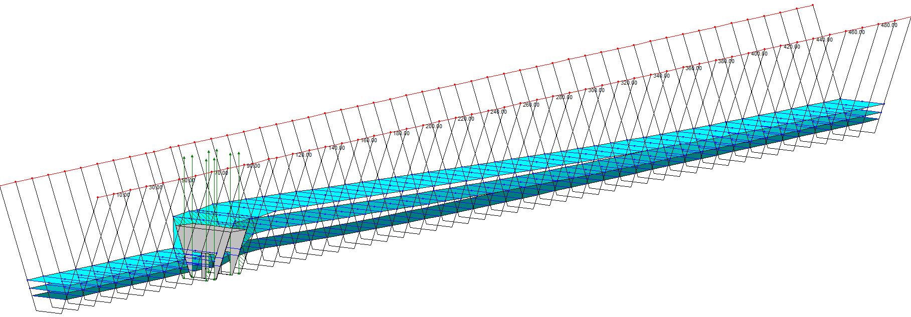
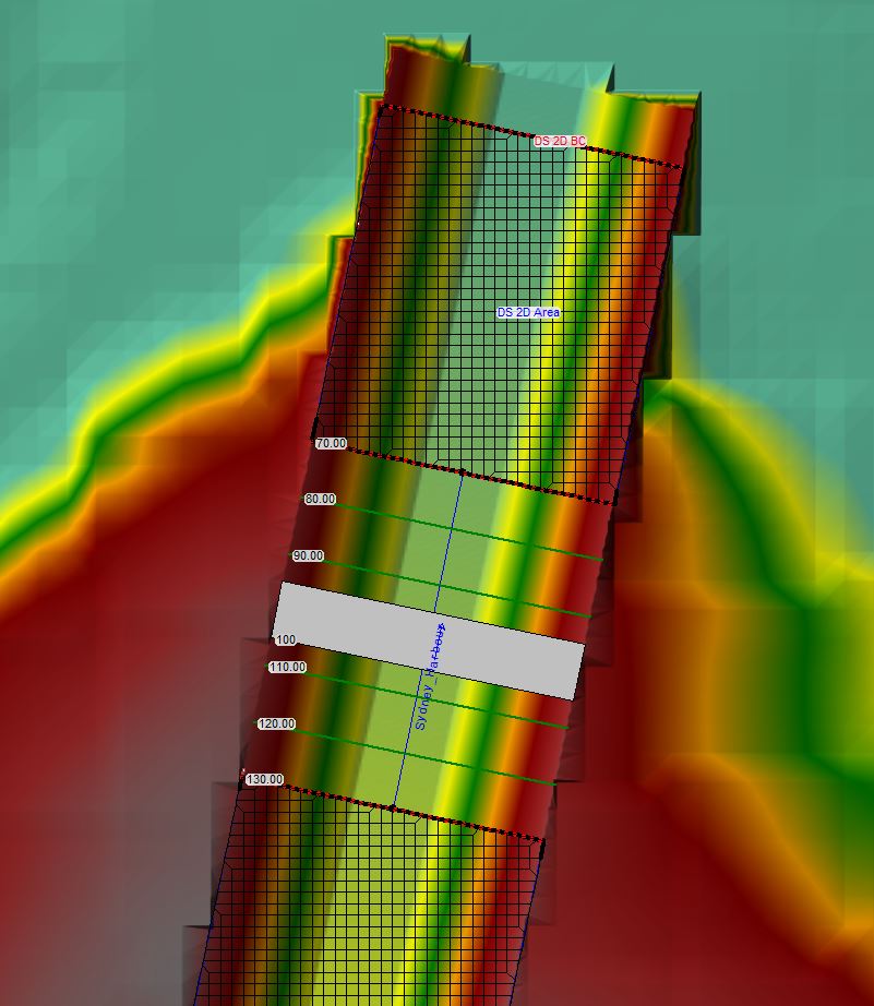
Here is the wireframe schematic for a 1D model that I set up to represent a uniform, trapezoidal channel with a single bridge crossing:
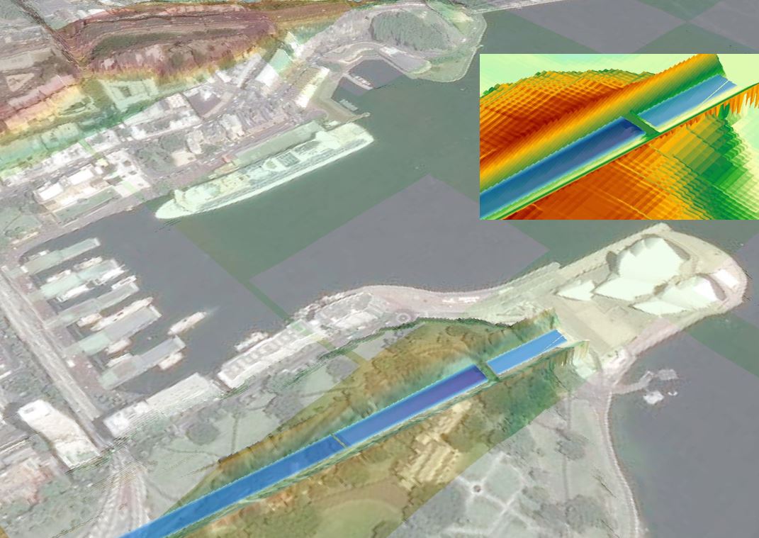
[The dimensions of the bridge and channel are presented in more detail in Part 4.] With the 1D geometry in place, I then used the cross sections to cut a channel through a 2D terrain surface. Here is the oblique view of the 2D geometry, which I’ve cut right through the middle of Sydney just for kicks:
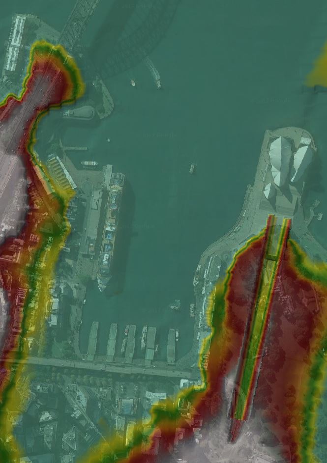
Here’s how the merged terrain appears in RAS Mapper and in the empty geometry viewer, with the Harbour Bridge on the upper left of the image and the Opera House on the right:
[By the way, if you’re interested in how to access free Australian terrain data for use in HEC-RAS – like the Sydney CBD terrain shown above – feel free to download the pdf file of Workshop #1 that we cover in our HEC-RAS 5.0 course. The workshop exercise will walk you through the process of extracting terrain data and loading it into RAS Mapper. To see how to then modify the terrain data to include a channel, see the links included in our article about terrain manipulation in HEC-RAS.]
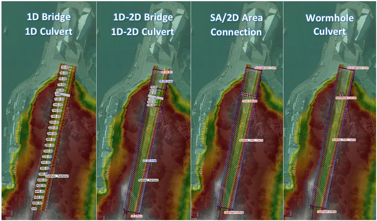
For this example, I generated a 0.5-metre by 0.5-metre DEM grid from the 1D trapezoidal cross sections (using “Export Layer | Create Terrain GeoTiffs from XS” in RAS Mapper). I then merged that terrain with the 5-metre grid resolution DEM that I downloaded from Geoscience Australia (using “Create New Terrain” in RAS Mapper). I then set up the following basic geometries in the Geometric Data Editor (click to enlarge):
1D Structure
For the 1D and coupled 1D-2D models, I used the bridge/culvert editor to place a roadway deck between the bounding cross sections. Here is the schematic:
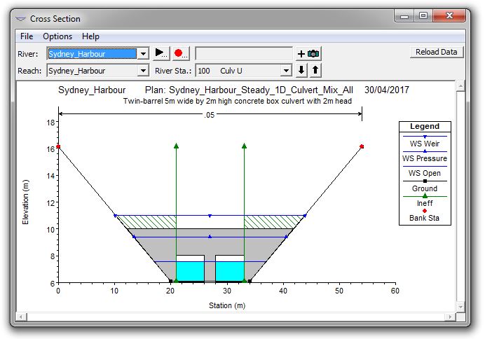
I then entered two openings under the roadway, using vertical abutments, piers, and upstream and downstream faces in order to allow the same geometry to be entered as either a bridge or a culvert. Here is the cross section of the bridge/culvert:
2D structure modelled as a standard SA/2D Area Connection
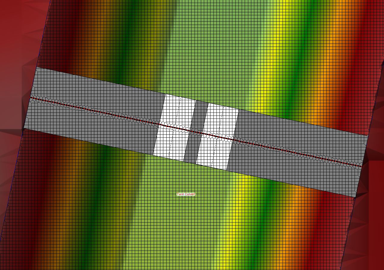
For the SA/2D Area Connection, I entered the roadway alignment as an enforced breakline and used the “Weir and Culverts” configuration to enter the embankment profile and culvert configuration (matching the geometry in the 1D bridge and culvert models). Here is the schematic plan view
Keep in mind that the weir/culvert in the SA/2D Area Connection model is connected at adjacent grid cells located on either side of the bridge centreline (as required by the documented limitations of HEC-RAS 5.0.3), with the bridge deck removed from the 2D terrain data and entered as a 1D weir embankment. Here is the embankment profile showing the location of the openings:
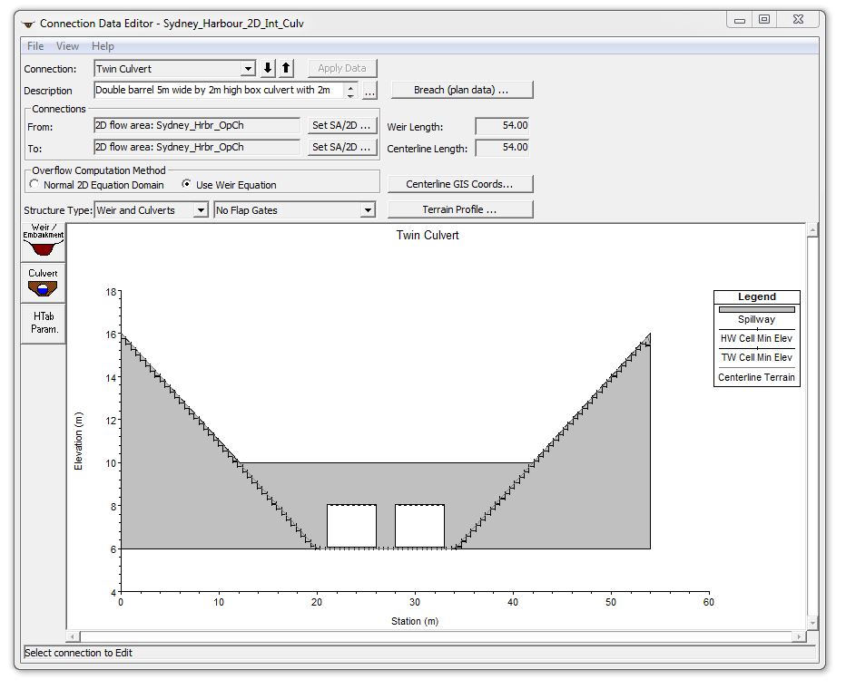
The entered weir width that is reflected in the plan view schematic represents the width of the roadway or bridge deck, and the hydraulics are computed using the entered culvert length (also reflected in the schematic plan); however, the water surface elevations used to balance weir flow and pressure flow are not taken at the inlet and outlet locations shown in the schematic view. Rather, they are taken at the grid cells directly adjacent to the alignment centreline. For some situations involving substantial terrain fluctuations between the inlet and outlet, this is entirely impractical; hence our need to come up with an alternative approach:
2D structure modelled as a wormhole culvert
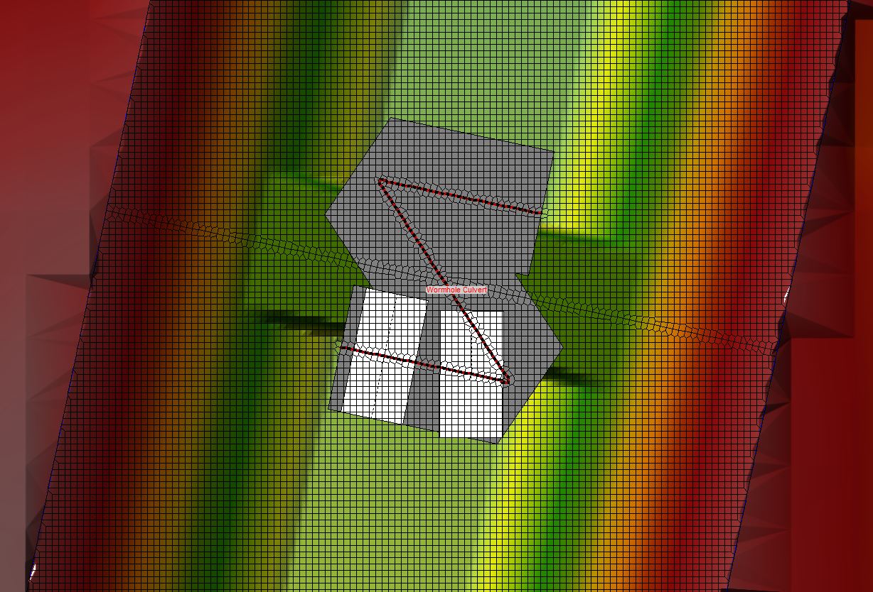
For the wormhole example, I entered a “Z”-shaped alignment as a SA/2D Area Connection using the technique described here. The wormhole culvert model retains the bridge deck in the 2D terrain data, with the culvert connected at the upstream and downstream bridge face (in our case separated by approximately 24 grid cells spanning 12 metres along the channel profile). Here is the plan view schematic using the weir width from the example above:
The schematic obviously doesn’t look right, so let’s have a closer look. Here’s the profile along the “Z”-shaped alignment of the connection:
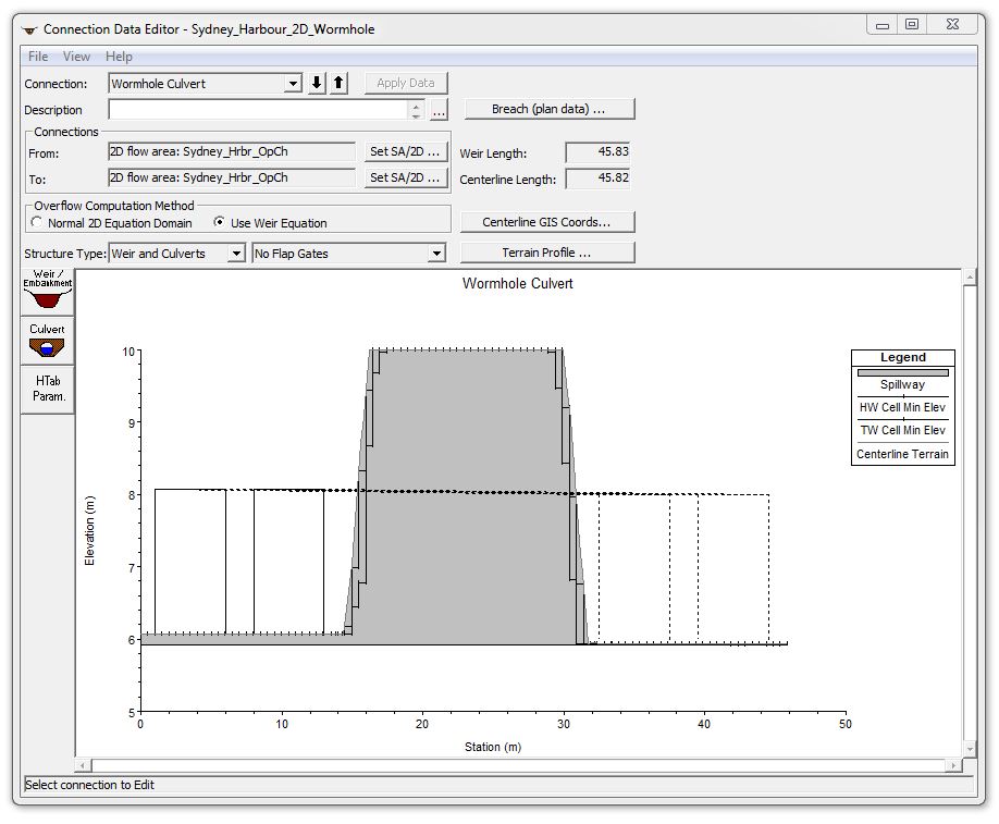
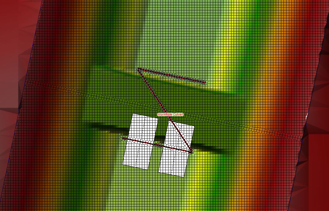
The profile also looks a bit odd: if this were a 1D model, the culvert barrels would be above the deck elevation and thus irrelevant to the hydraulics. For our wormhole example, though, the weir that runs along the embankment alignment is essentially just a line painted on the ground. Because it isn’t raised, the crest doesn’t behave like a classical weir, and the length of the alignment does not represent a weir length. Likewise, roadway width should not be entered as the weir width, since HEC-RAS would try to use it to balance a broad-crested weir equation. For this case, the width I select for the weir will show up in the schematic view, but it will be irrelevant to the hydraulics because I will change the Overflow Computation Method (shown in the screenshot above) from “Use Weir Equation” to “Normal 2D Equation Domain”. The weir width can be changed to anything you like, or it can be left off entirely; it will be used purely for graphical display. Here is the resulting schematic view with a reduced weir width:
The schematic still doesn’t look right in terms of the culvert inlet and outlet locations, but as we’ll see below, hydraulically it functions just fine. The hydraulic computations do not draw from the grid cells at the culvert inlet and outlet locations shown in the schematic; rather, they are based on the grid cells on the upstream face of the southern portion of the alignment line for the headwater, and the grid cells directly adjacent to the downstream face of the northern portion of the alignment line for the tailwater – at least that’s what I suspect; let’s turn to the results to see if that’s really the case!
Model results
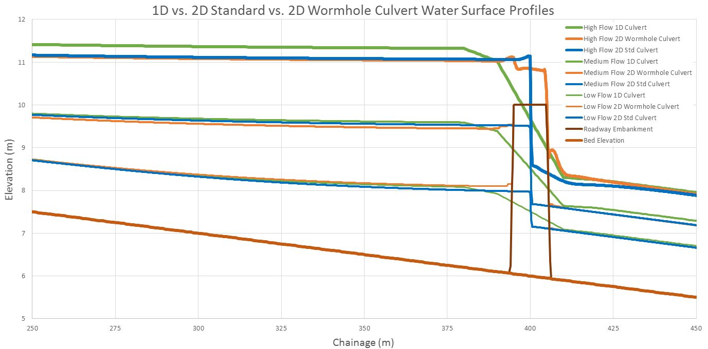
With each of the geometries in place, I set up separate plan files using three flow rates (selected to demonstrate open channel flow, pressure flow, and weir flow conditions). I then adjusted a range of approaches and coefficients as a sensitivity analysis. The extended results are included in a separate post here, but in summary, here are the water surface elevation profiles for the 1D, 2D internal connection, and 2D wormhole runs:
As you can see, the wormhole culvert behaves very similarly to the internal connection, with maximum depth results matching within approximately 2%. The 1D and 2D results match each other very closely for both the open channel flow and the pressure flow scenarios, with the greatest difference (approximately 5%) being associated with the weir flow scenario. You would expect the results to be similar for this simplified example if indeed the hydraulics are being computed as expected; for a more complex example involving detailed terrain between the inlet and outlet, however, I believe wormhole culverts would be able to provide much more realistic results that the standard method simply can’t handle at the moment. And as a bonus, the animations will look much more realistic using wormhole culverts. Even though the schematic plan looks goofy in the geometry viewer, those alignments won’t show up in RAS Mapper – you’ll only see the terrain and the results.
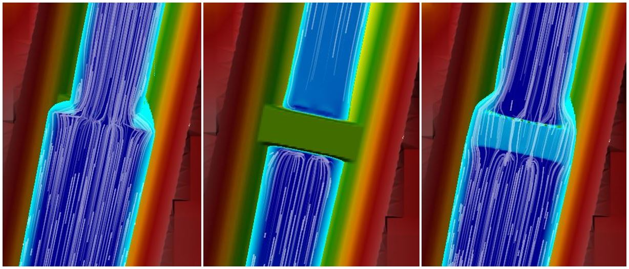
As shown in the particle tracing figure below, the standard weir and culvert shown on the left will display water right up the alignment line for all flow situations (open channel, pressure, and weir flow) while the wormhole culvert will show the dry roadway deck for open channel and pressure flow (centre image) and weir flow over the deck for overtopping conditions (right image):
Likewise as we saw in the profile views, the standard method unrealistically shows the bridge deck as a glass wall with no thickness, whereas the wormhole method correctly depicts the terrain and the water flowing over or against the terrain.
Summary (“Tear Down the Wall!”)
Given these results, I definitely prefer the wormhole culvert. Keep in mind that if your terrain has already been removed for your roadway or bridge deck (as you would need to do in order to use the standard culvert method in a 2D model), you’ll need to use terrain lifting to put it back in for the wormhole method to work properly.
For anyone interested in getting geeked out on this even further, Part 4 includes an extended discussion describing the model setup in detail and showing results for the following sensitivities:
- 1D steady flow vs. 1D unsteady flow
- 1D bridge vs. 1D culvert
- Default 1D bridge parameters vs. customised 1D bridge parameters
- Subcritical vs. mixed flow for 1D steady flows
- Mixed flow toggled on and off for 1D and 2D unsteady flows
- Full momentum vs. diffusion wave for 2D unsteady flows
- Bridge deck modelled as weir vs. 2D terrain for overtopping 2D flows
- Bridge modelled as box culvert vs. gate for 2D flows
- Blocked openings vs. no blockage for overtopping flows
- Grid size sensitivity (0.5 metres to 20 metres)
- Time step sensitivity (0.1 seconds to 2.0 seconds)
I typically use wormhole culverts to avoid having to remove bridge decks and roadways from terrain data, which can be a very time-consuming process in HEC-RAS – particularly in some of my larger models that have dozens of bridges and culverts. Given the number of wormhole culverts that are already in my models, I needed to walk through this exercise on my own anyway to convince myself of their validity – and to continue saving myself time on terrain manipulation – but hopefully posting the results online will be helpful to others as well.
In the end, the results do set my mind at ease a bit by at least demonstrating similar hydraulic results between the two 2D methods. Given the limitations of using depth-averaged techniques inherent in all 1D and 2D models – regardless of the selected bridge modelling approach – getting accurate results for the balance between bridge/culvert flow and weir flow under submerged conditions is challenging at best; but in this case, at least we are seeing consistency between the methods. In some cases, 3D CFD models may be better suited for detailed designs.
This is admittedly as simple a model as you could possibly set up to test it out; perhaps someone with more time on their hands can do a more robust comparison with a more complex model – I would love to see the results if anyone gives it a try. If anyone is interested in playing around with the model that I set up, please e-mail me and I can provide a download link for the model files. If anyone has the time to give it a go in TUFLOW, MIKE, or other software, I’d be interested in including those comparisons in a follow-up article.
Please note that all of the disclaimers in Chris Goodell’s blog post about modelling bridges in HEC-RAS 2D apply here as well – in particular the fact that while these methods can be used to account for a bridge or culvert in a larger floodplain model, they should not be used to design the actual structure itself; that requires a much more robust approach than what I’ve shown here. At this point 2D models can be used to incorporate structures as we’ve seen above, but detailed options for bridge piers, etc. or detailed output for internal culvert hydraulics currently are still only available in 1D, requiring the development of a full 1D or coupled 1D-2D model if that’s what you’re after.
I’ve actually been procrastinating this exercise for some time now, hoping that the next release of HEC-RAS would come along without these limitations and make everything I’ve done here obsolete. Given the uncertainties around release dates, however, in the meantime I thought I’d at least share this simple example comparing the hydraulics of a 2D wormhole culvert to the standard 1D and 2D methods.
Read more:
- Wormhole Culverts Part 1: Introducing the wormhole concept
- Wormhole Culverts Part 2: Using wormhole culverts for internal boundary conditions
- Wormhole Culverts Part 3: Comparing wormhole culverts to 1D/2D bridges and culverts
- Wormhole Culverts Part 4: Sensitivity analyses for wormhole culverts
- Wormhole Culverts Part 5: What’s the best shape for a wormhole culvert?
Contact and feedback:
- Please e-mail me any comments or questions about wormhole culverts or other topics
- Contribute to the discussion about wormhole culverts on the RAS Solution blog
- Subscribe to receive updates when new content is published
- Join the newly created LinkedIn groups for dam break modelling and sediment transport modeling
Krey Price
Surface Water Solutions

